Beach2Beach
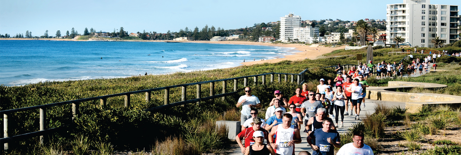
Dee Why to Newport
-
Half Marathon – Dee Why Beach
06:30
14km Start – Dee Why Beach 08:00
6km Start – Rat Park 09:00
3km Start – Apex Park 09:30
Finish – Newport Beach 12:30
Important Travel Advice
Around 5,500 participants are expected to take part in this year’s Beach2Beach charity fun run and festival, with event starting points in Dee Why, North Narrabeen and Mona Vale. Events will finish at Newport Beach.
Transport
- Public transport is the best way to get to your start area in Dee Why, North Narrabeen or Mona Vale. See the events overview for course details.
- Plenty of regular route buses run from the city and lower north shore to get you within close walking distance of your start area, including frequent B-Line bus services.
- Trains, buses, metro and light rail services run regularly to the city where you can connect with bus services to the Northern Beaches. Plan your trip using the Trip Planner.
- Some buses will be using different routes and stops while road closures are in place. Keep this in mind and plan your trip ahead of time.
- You'll need to use an Opal card or contactless payment card/device when travelling on public transport to and from the event. Register your details online at Opal or via the Opal Travel app ahead of time.
Road closures and clearways
- Roads along the course will start to close at 5.30am between Dee Why and Newport. Roads will progressively reopen from 7.30am with all roads reopened by 12.30pm.
- Special event clearways, temporary lane closures and speed limit reductions will be in effect from 4am on sections of Pittwater Road and Barrenjoey Road. Conditions will return to normal by 12:30pm.
- See the Interactive Map for details of closures and clearways or view the road closure & clearway maps;
- Limited car-parks and on-street parking is available near each start area. Remember to check signs clearly as vehicles parked in signposted clearways will be towed and a fee applies. If you plan to drive and park, carpool with your group and allow extra time for walking to the start line.
For detailed road closure information visit livetraffic.com.
Opal
You can use an Opal card for all modes of public transport in Sydney and surrounding regions, including metro, trains, buses, ferries and light rail.
Remember to top up your Opal card before you travel to avoid waiting in line at top-up machines. You can top up your card online or at an Opal retailer.
More ways to pay
If you have a contactless-enabled American Express, Mastercard or Visa debit or credit card, or a linked device, you can use it to pay for your travel by tapping on and tapping off at Opal card readers. Available on all public transport services including metro, trains, buses ferries and light rail, contactless payments are another way to pay on the Opal network. Adult Opal fare pricing applies and you will receive Opal benefits, including daily and weekly fare caps.
Sydney Metro services are high-frequency, driverless trains running between Sydney’s north-west and south-west via the city.
The M1 Line operates turn up-and-go Metro services between Tallawong, Chatswood and Sydenham from early morning until late.
Change at Chatswood or Victoria Cross to connect with regular route buses towards the Northern Beaches.
For Metro service disruption information, check trackwork and travel alerts or plan your trip using the Trip Planner.
The closest train stations with bus connections to the Northern Beaches are Wynyard, Chatswood and North Sydney.
Trackwork
Planned trackwork is taking place on Sunday 23 August on the following lines and may affect how you travel to and from the event. Plan ahead the Trip Planner.
- T1 North Shore Line: Buses replace trains between Berowra and Gordon. Trains run between Gordon and the City, some to a changed timetable.
- T1 Western Line: Richmond trains run to a changed timetable and stopping pattern between Richmond and Liverpool only. Change trains at Parramatta to continue your journey.
- T2 Leppington & Inner West Line: Trains run to a changed timetable and stopping pattern between Leppington and the City via Granville or Regents Park. Inner West trains run between Homebush and the City, some to a changed timetable.
- T3 Liverpool & Inner West Line: Trains run to a changed timetable and stopping pattern between Leppington and the City via Regents Park. Inner West trains run between Homebush and the City, some to a changed timetable.
- T4 Eastern Suburbs & Illawarra Line: From 5.40am to 8am, trains run between Cronulla or Waterfall and the City Circle, and between Central and Bondi Junction only. You may need to change trains at Central or Town Hall to continue your journey. Trains make extra stops at St Peters and Erskineville.
- T6 Lidcombe & Bankstown Line: Trains run to a changed timetable and reduced frequency, every 30 minutes
- T7 Olympic Park Line: Buses replace trains between Olympic Park and Lidcombe.
- T8 Airport & South Line: From 5.40am to 8am, trains run to a changed timetable between Sydenham and the City Circle.
- T9 Northern Line: Buses replace trains between Hornsby and Strathfield. Trains run to a changed timetable between Strathfield and the City.
- Blue Mountain Line: Trains run to a changed timetable between Blue Mountains Line stations and Blacktown only. T1 Western Line trains run between Penrith, Blacktown and the City. Trains from Blacktown to Blue Mountains Line stations run 30 minutes later than normal.
- Central Coast & Newcastle Line: Buses replace trains between Newcastle Interchange and Gordon. T1 North Shore Line trains run between Gordon and the City, some to a changed timetable.
- Hunter Line: Buses replace trains between Scone, Dungog and Newcastle Interchange.
- South Coast Line: From 2.20am to 11.50am, buses replace trains between Bomaderry, Port Kembla and Wollongong. Trains run between Wollongong and the City Circle or Bondi Junction, some to a changed timetable. The 02:39 Kiama to Bondi Junction service will run up to 20 minutes earlier than the normal timetable from Kiama to Coniston, then run to the normal timetable from Wollongong to Bondi Junction. The first train leaves Wollongong at 11:05, arriving Kiama at 11:47.
Trackwork is carried out on an ongoing basis to maintain the safety, reliability, and efficiency of the Sydney Trains network. For the latest information, check trackwork and travel alerts or plan your trip using the Trip Planner.
Plenty of regular route buses from the city and lower north shore, including frequent B-Line services, make stops within short walking distance of the start areas in Dee Why, Warriewood and Mona Vale.
B-Line buses run every 10 minutes on weekends making stops at Mona Vale, Warriewood, Narrabeen, Collaroy, Dee Why, Warringah Mall, Manly Vale, Spit Junction, Neutral Bay Junction and Wynyard.
You'll need to use an Opal card or contactless payment card/device when travelling on public transport to and from the event. Register your details online at Opal or via the Opal Travel app ahead of time.
Getting there
- To get to the Half Marathon and 14km start line at Dee Why Beach, catch a B-Line service to Dee Why B-Line, Pittwater Road. The start line at The Strand, Dee Why Beach is a 15-minute walk via Howard Avenue.
- To get to the 6km start line in Warriewood, catch a B-Line service to Warriewood B-Line, Pittwater Road. The start line at Rat Park, behind the parking station adjacent to Walsh Street, is an 11-minute walk via Walsh Street. Alternatively, route 199 also makes stops on Pittwater Road.
- To get to the 3km start line in Mona Vale, catch a B-Line service to Mona Vale B-Line, Barrenjoey Road. The start line at Apex Park is a 10-minute walk via Barrenjoey Road and Seabach Avenue. Alternatively, catch a route 199 bus that stops on Barrenjoey Road at Darley Street.
Getting home
- From the finish festival at Newport Beach, catch the free Beach2Beach shuttle bus that will run regularly between 8.30am to 11am to Dee Why via the Mona Vale B-Line stop on Barrenjoey Road and Warriewood. From the Mona Vale B-Line stop you can connect with frequent B-Line services or other regular route buses from Barrenjoey Road and Pittwater Road.
- Alternatively, catch route 199 buses from Barrenjoey Road near Newport Surf Club for services towards Manly via Mona Vale and Dee Why. Services run regularly.
Bus diversions
Buses in Mona Vale, Dee Why and Freshwater will be diverting and using different stops while road closures are in place for the event. Delays are expected so bus customers are encouraged to plan ahead, allow plenty of extra travel time and check signs at bus stops for more information.
From 7am to 11.30am
- Route 155: Services travelling towards Narrabeen will divert away from Coronation Street via Pittwater Road, Albert Street and Lagoon Street to return to route on Waterloo Street. Services to Mona Vale will run as normal. Stops will be missed on Corronation St, Narrabeen Park Pde, Sydney Rd, Ocean St and Waterloo St.
From 5.30am to 8.30am
- Route 166: services in both directions will divert away from closures between Dee Why and Curl Curl via Pittwater Road, Harbord Road and Brighton Street. Stops will be missed on Howard Ave, Oaks Ave, The Strand, Griffin Rd, Adams St and Bennett St.
- Route 167: services in both directions will divert away from closures between Dee Why and Curl Curl via Wyndora Ave, Carlton St, Evans St and Charles St. Stops will be missed on Evans St, Lumsdaine Dr, Carrington Pde, Adams St, Bennett St and Oliver St.
For service disruption information check travel alerts or use the Trip Planner.
Sydney Ferries will operate to a regular Sunday timetable and services don't start running until later in the morning. If you are doing the Half Marathon or 14km events, catch early morning buses to get to the start line instead. Plan your trip using the Trip Planner.
Catch one of the many ferry services to Circular Quay and change for a train service to Wynyard to connect with regular route buses, including frequent B-Line services, leaving from Carrington Street towards the Northern Beaches to get to the starting lines in Dee Why, Warriewood and Mona Vale.
Alternatively, catch an F1 ferry service from Circular Quay to Manly and change for a regular route bus towards the start lines. F1 ferry services leave Circular Quay after 6.30am on a Sunday.
For ferry service disruption information, check travel alerts or plan your trip using the Trip Planner.
L1 Dulwich Hill Line
L1 Dulwich Hill Line light rail services run between Central Station (Grand Concourse) and Dulwich Hill via Darling Harbour and the Inner West. Services run regularly from 6am to 11pm daily, and until midnight on Friday. Plan your trip using the Trip Planner.
Change at Central for trains or light rail towards Wynyard to connect with buses to the Northern Beaches leaving from Carrington Street.
L2 Randwick and L3 Kingsford Lines
L2 Randwick Line light rail services run between Circular Quay and Randwick via Central Station (Chalmers Street) and L3 Kingsford Line services run between Circular Quay and Juniors Kingsford via Central Station (Chalmers Street). Services run regularly from 5am to 1am daily. Plan your trip using Trip Planner.
Change at Wynyard to connect with buses to the Northern Beaches leaving from Carrington Street.
L4 Westmead and Carlingford Line
L4 Westmead and Carlingford Line light rail services run between Carlingford and Westmead via Parramatta CBD. Services run regularly from 5am to 1am daily. Plan your trip using the Trip Planner.
Alight at Parramatta Square and connect with a train service to Wynyard. Change at Wynyard to connect with buses to the Northern Beaches leaving from Carrington Street.
Passengers are reminded that trams can’t stop quickly or easily – so please stop, listen and look around for trams and use designated pedestrian crossings. Read the news story for more information.
For maps and service frequencies see light rail service information. For light rail service disruption information, check travel alerts or plan your trip using the Trip Planner.
Roads along and surrounding the course will be closed to general traffic. Access for local residents will be maintained when safe to do so after runners have safely passed by along the course.
If you’re planning on driving in the area during the event, allow plenty of extra travel time as traffic is expected to be heavier than usual while roads and lanes are closed, and speed reductions are in place.
See the Beach2Beach interactive map for course details and changed traffic conditions.
Road closures
Road closures will be in place between 5.30am and 12.30pm along the course from Dee Why to Newport to safely facilitate the event. Roads will start to progressively reopen from 7.30am.
- Dee Why/Freshwater:
- From 5.30am to 7.30am: Sections of Boronia Street, Griffin Road, The Strand, Howard Ave, Strand Lane and Pacific Parade will be closed.
- From 5.30am to 8.30am: Sections of Carrington Parade, Lumsdaine Drive, Griffin Road, Headland Road, Ozone Parade and other local streets will be closed.
- Between 6.20am and 8.30am: Sections of Oaks Avenue will be closed.
- Collaroy from 6am to 9.30am: Sections of Anzac Avenue, Beach Road and Florence Avenue will be closed.
- Narrabeen/Warriewood from 6.30am to 10.30am:
- Narrabeen Park Parade southbound lanes will be closed between Cook Terrace (Mona Vale) and Sydney Road. One-way traffic northbound only will be maintained.
- Narrabeen Park Parade southbound lanes will be closed between Sydney Road and Malcolm Street. One way traffic northbound will be maintained.
- Peal Pl will be under managed access for residents via Narrabeen Park Pde northbound.
- A section of Sydney Road and Melbourne Avenue will also be closed.
- Mona Vale from 7am to 11am: Sections of Surfview Road, Orana Road and Bassett Street will be closed.
- Mona Vale from 7am to 12:30pm: Grandview Parade between Barrenjoey Road and Orana Road will be closed southbound.
- Newport from 7.15am to 12.30pm: Sections of Ross Street, Palm Road, Calvert Parade, The Boulevard and Myola Road around the beach will be closed.
Managed access for residence will be maintained in some closure areas when safe to do so. See the road closure and clearway maps for more details:
- Interactive Map
- Map 1: Freshwater to Dee Why (pdf 900KB)
- Map 2: Dee Why to Narrabeen (pdf 1.3MB)
- Map 3: Narrabeen to Newport (pdf 1.4MB)
For detailed road closure, lane closure, clearway, speed reduction and event course information, visit livetraffic.com.
Lane closures
- Pittwater Road:
- From 4am to 10am: Two southbound lane closures will be in place on Pittwater Road between Anzac Avenue and Hawkesbury Avenue.
- From 4am to 10:30am: One southbound lane closure on Pittwater Road between Devitt Street and Alexander Street.
- Barrenjoey Road:
- From 4:30am to 12:30pm: One southbound lane closure on Barrenjoey Road between Palm Road and Grandview Parade.
Speed reductions
- Collaroy to Dee Why from 4am to 10am: The southbound speed limit on Pittwater Road will be reduced to 40km/h between Anzac Avenue and Hawkesbury Avenue.
- Collaroy from 4am to 10:30am: The southbound speed limit on Pittwater Road will be reduced to 40km/h between Devitt Street and Alexander Street.
- Newport to Mona Vale from 4:30am to 12:30pm: The southbound speed limit on Barrenjoey Road will be reduced to 40km/h between The Boulevarde in Newport to Grandview Parade in Mona Vale.
Cycleway closure
- Dee Why from 5.30am to 8.30am: The cycleway on The Strand between Dee Why Parade and Oaks Avenue.
For the latest traffic information visit Live Traffic NSW or download a real-time traffic app.
Parking
Limited parking is available at Mona Vale Surf Club, James Meehan Reserve carpark, Howard Avenue carpark, Dee Why Civic Centre carpark, Pittwater Rugby Park (Rat Park) and Mona Vale Surf Club. There’s also on-street parking available on surrounding streets around each starting line.
Clearways
Special event clearways will be in effect from 4am to 12:30pm on the eastern side of Barrenjoey Road between Palm Road (Newport) and Grandview Parade (Mona Vale), from 4am to 10am on the eastern side of Pittwater Road between Anzac Avenue (Collaroy) and 50m north of Hawkesbury Avenue (Dee Why), and from 4am to 10:30am on the eastern side of Pittwater Road between Devitt Street (Narrabeen) and Alexander Street (Collaroy) .
Clearways are strict no-parking zones for all vehicle types and apply even to local residents and TfNSW Mobility Scheme Permit holders. Check signs carefully as vehicles left in clearways will be towed and a fee applies. If your vehicle is towed, you can search your vehicle registration at the Find My Car website to find its new location, or alternatively call 132 701 to speak to an operator.
Visit Live Traffic NSW for more details.
Accessible trips are shown in the Trip Planner with the wheelchair icon. You can select "accessible services only" in the Options to ensure you only see accessible services. Only trip plans with accessible train platforms, ferry wharves and buses will be presented. See accessible travel or download a transport app (select the "Accessibility" filter).