MS Gong Ride 2026
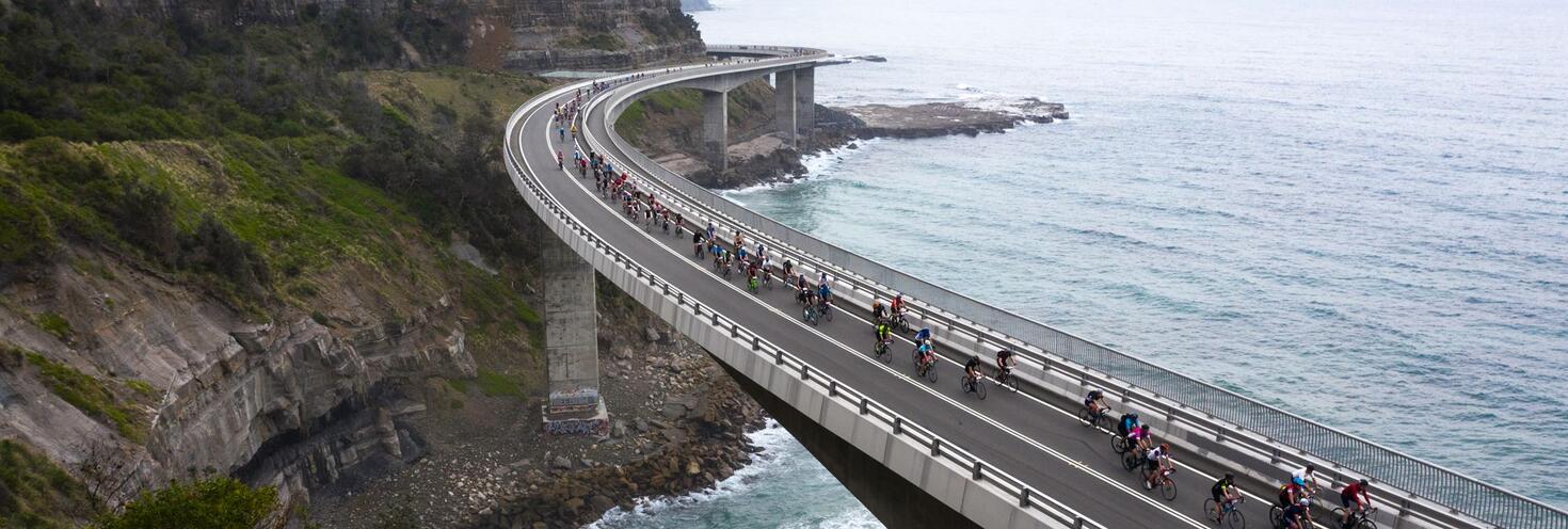
Tempe and Engadine to Fairy Meadow
-
80km ride start from
06:00
53km ride start from 08:00
Finish 15:30
Important event information
Up to 10,000 cyclists will take part in the 45th annual MS Gong Ride. The 80km ride will start from Tempe Recreational Park at 6am, and the 53km ride will start from Preston Park, Engadine at 8am. Both rides finish at Thomas Dalton Park, Fairy Meadow by 3:30pm.
- Participants are encouraged to plan their trips ahead of time. Trains are the best way to travel with your bike however be aware of trackwork affecting parts of the network on Sunday.
- Additional early morning trains will run on the South Coast Line towards Sydney to get you to the start lines. The closest stations to the 80km start line are Tempe, Wolli Creek and Sydenham. The closest station to the 53km start line is Engadine.
- After the ride, dedicated special event trains will run regularly from Fairy Meadow station back towards Central. Remember to show your MS Gong Ride pre-purchased train ticket when boarding services.
- Trackwork: planned weekend trackwork is taking place across parts of the rail network that may affect how you get to and from the event.
- Buses replace trains between Central and Strathfield or Olympic Park until 10am Sunday. If you're travelling from the west you'll need to catch trains to Glenfield to connect with T8 Line trains to Wolli Creek or Sydenham.
- Buses replace trains between Hornsby and Berowra on the T1 North Shore Line, between Hornsby and Strathfield on the T9 Northern Line, and full closure of the Central Coast & Newcastle Line, and Hunter Line across the weekend.
- Plan your trip as bikes cannot be taken on board buses including rail replacement buses.
- Due to road closures, some buses will be diverting from their regular routes and using different stops along the event course.
- Bikes on transport: Bicycles cannot be carried on buses and will only be permitted on ferries and light rail services at the discretion of the crew or drivers if there is safe space available. Learn more about travelling on public transport with bikes.
- For the majority of the course, riders will be sharing roads with general traffic. Along key sections of the ride, some road closures, lane closures, special event clearways and speed reductions will be in place for the safety of the riders.
- Allow extra travel time as traffic may be heavier than usual, you can find real-time updates on traffic conditions at livetraffic.com
Stay connected
Stay connected and get real-time updates on the event, transport services, traffic and road closures:
- Event updates follow @MSGongRide on X (Twitter) and on Facebook.
- Transport updates: follow @TrainsInfo, @BusesInfo, @FerriesInfo and @SydneyMetro
- Road closures and traffic: follow @ Live Traffic NSW on Facebook.
- See the Interactive road closure and clearway web map for details of traffic changes across the entire course from Sydney towards Wollongong.
Special Event Trains
After the ride, dedicated special event trains will run regularly from Fairy Meadow Station back towards Central. Remember to show your MS Gong Ride pre-purchased train ticket when boarding the services.
These pre-purchased tickets cannot be used for travel to the Tempe Recreation Reserve (long course) or Preston Park Reserve (short course) start sites on Event Day.
Opal
For travel to the start lines, participant will need to use an Opal card or contactless payment method to pay for travel.
You can use an Opal card for all modes of public transport in Sydney and surrounding regions, including metro, trains, buses, ferries and light rail.
Remember to top up your Opal card before you travel to avoid waiting in line at top-up machines. You can top up your card online or at an Opal retailer.
More ways to pay
If you have a contactless-enabled American Express, Mastercard or Visa debit or credit card, or a linked device, you can use it to pay for your travel by tapping on and tapping off at Opal card readers. Available on all public transport, contactless payments are another way to pay on the Opal network. Adult Opal fare pricing applies and you will receive Opal benefits, including daily and weekly fare caps.
Sydney Metro services are high-frequency, driverless trains running between Sydney’s north-west and south-west via the city.
The M1 Metro North West & Bankstown Line operates turn up-and-go Metro services in both directions between Tallawong, Chatswood, and Bankstown.
Catch a metro service to Sydenham and ride 7 minutes to the 80km course start line at Tempe Recreational Park.
Change at Sydenham to connect with T4 Line trains to Engadine for access to the 53km course start line.
For Metro service disruption information, check travel alerts or plan your trip using the Trip Planner.
Participants are reminded to be considerate when sharing trains with the rest of the public as stations will be busier than normal. Make sure your bicycle is stowed safely with you when travelling on trains and that it isn't obstructing doorways or passageways.
Trackwork: planned weekend trackwork is taking place across parts of the rail network that may affect how you get to and from the event.
- Buses replace trains between Central and Strathfield or Olympic Park until 10am Sunday. If you're travelling from the west you'll need to catch trains to Glenfield to connect with T8 Line trains to Wolli Creek or Sydenham.
- Buses replace trains between Hornsby and Berowra on the T1 North Shore Line, between Hornsby and Strathfield on the T9 Northern Line, and full closure of the Central Coast & Newcastle Line, and Hunter Line across the weekend.
- Plan your trip as bikes cannot be taken on board buses including rail replacement buses.
Getting there
- Start line at Tempe: the closest stations to the 80km starting point are Tempe, Wolli Creek and Sydenham on the T4 Eastern Suburbs & Illawarra Line. Tempe Recreation Reserve is a less than 10 minutes ride from these stations.
- Start line at Engadine: the closest station to the 53km starting point is Engadine on the T4 Eastern Suburbs & Illawarra Line. Preston Park is a short 2 minute cycle ride away.
Additional early morning services will run to help you get to the starting line:
- South Coast Line
- Additional services will leave from Wollongong at 4:23am, 4:37am, 5:22am, and 5:53am stopping all stations to Austinmer, then Stanwell Park, Helensburgh, Engadine, Sutherland, Hurstville, Wolli Creek, Tempe, Sydenham, Redfern, Central, and then all stations to Bondi Junction.
- Trains leaving Wollongong at 4:56am, 5:31am, and train leaving Kiama at 5:57am will make an additional stop at Wolli Creek and Tempe.
- Train leaving Bondi Junction at 6:15am will make an additional stop at Engadine.
- Please note: From 9am to 6pm, buses replace trains from Port Kembla to Wollongong on the South Coast Line to allow the special event trains to run.
- T4 Illawarra Line: all services will make an additional stop at Wolli Creek and Tempe between 5.30am and 8am.
- T8 Airport & South Line: all services will an additional stop at Wolli Creek between 5:30am and 8:30am
Getting home
The closest station from the finish line at Thomas Dalton Park is Fairy Meadow on the South Coast Line.
- Dedicated special event trains for participants will run from Fairy Meadow to Central/Bondi Junction every 30 minutes between 9:30am and 5:30pm.
- Services will make stops at Thirroul, Stanwell Park, Otford, Waterfall, Engadine, Sutherland, Hurstville, Wolli Creek, Tempe, Sydenham, Redfern, Central then all stations to Bondi Junction. Most services departing after 2pm will terminate at Central.
- Participants need to show their $8 MS Gong Ride pre-purchased train ticket when boarding services. Opal cards cannot be used on these special event trains. You can also purchase a special event train ticket at the finish line.
Trackwork
Planned weekend trackwork is taking place on Sunday 1 November and may affect how you travel to and from the event. Plan your trip using the Trip Planner.
- T1 North Shore Line: Buses replace trains between Berowra and Hornsby. Trains run between Hornsby and the City, some to a changed timetable. From 2am to 10am, trains run between Hornsby, the City and Ashfield only. Buses replace trains between Central and Strathfield or Olympic Park
- T1 Western Line: Trains run to a changed timetable and stopping pattern. Penrith trains make extra stops at all stations between Lidcombe and Ashfield. Richmond trains run between Richmond and Liverpool. Change trains at Parramatta to continue your journey towards the City. From 2am to 10am, buses replace trains between Olympic Park and Ashfield. Express buses also run between Olympic Park and Central. Replacement buses do not leave from Lidcombe
- T2 Leppington & Inner West Line: Inner West trains do not run. T1 Western and T2 Leppington trains make extra stops. Trains run to a changed timetable between Leppington and T1 North Shore Line stations via Granville or Regents Park and stop at all stations between Ashfield and Central. You will need to change trains if travelling to Museum, St James or Circular Quay. From 2am to 10am, buses replace trains between Olympic Park and Ashfield. Express buses also run between Olympic Park and Central. Replacement buses do not leave from Lidcombe. Trains run to a changed timetable between Leppington or Glenfield and Olympic Park, between Glenfield and the City via the Airport and between Ashfield and the City, continuing to T1 North Shore Line station. You may need to change services to continue your journey. From 8am to 2pm, buses replace trains between Leppington and Glenfield.
- T3 Liverpool & Inner West Line: Inner West trains do not run. T1 Western and T2 Leppington trains make extra stops. Trains run between Leppington and T1 North Shore Line stations via Regents Park, stopping at all stations between Ashfield and Central. You will need to change trains if travelling to Museum, St James or Circular Quay. From 2am to 10am, buses replace trains between Olympic Park and Ashfield. Express buses also run between Olympic Park and Central. Replacement buses do not leave from Lidcombe. Trains run to a changed timetable between Liverpool and Lidcombe, between Lidcombe and Olympic Park and between Ashfield and the City, continuing to T1 North Shore Line stations. You may need to change services to continue your journey.
- T5 Cumberland Line: Some trains run to a changed timetable. Extra trains run between Richmond and Liverpool. From 8am to 2pm, buses replace trains between Leppington and Glenfield. Trains run between Richmond or Schofields and Liverpool.
- T6 Lidcombe & Bankstown Line: Trains run to a changed timetable and reduced frequency, every 30 minutes.
- T7 Olympic Park Line: From 2am to 10am, trains run to a changed timetable and stopping pattern between Olympic Park and Penrith or Leppington. Buses replace trains between Olympic Park and Ashfield. Express buses also run between Olympic Park and Central. Replacement buses do not leave from Lidcombe.
- T9 Northern Line: Buses replace trains between Hornsby and Strathfield. Trains run to a changed timetable between Strathfield and the City. Frequent metro services between Epping and the City. From 2am to 10am, buses also replace trains between Strathfield and Central.
- Blue Mountains Line: Trains run to a changed timetable between Blue Mountain Line stations and Blacktown only. Use T1 Western Line trains between Blacktown and Central. Trains from Blacktown to Blue Mountains Line stations run 30 minutes later than the normal timetable. Bathurst trains continue to run between Bathurst and Lithgow or Central. From 2am to 10am, buses replace trains between Olympic Park and Central.
- Central Coast & Newcastle Line: Buses replace trains between Newcastle Interchange and Hornsby. T1 North Shore Line trains run between Hornsby and the City, some to a changed timetable.
- Hunter Line: Buses replace trains between Scone, Dungog and Newcastle Interchange. Limited express buses also run between some Hunter Line stations and Hornsby.
- South Coast Line: From 9am to 6pm, buses replace trains from Port Kembla to Wollongong. From 10am to 6.30pm, buses replace trains from Wollongong to Port Kembla. Trains run to a changed timetable between Wollongong, Thirroul and Bondi Junction.
Trackwork is carried out on an ongoing basis to maintain the safety, reliability, and efficiency of the Sydney Trains network. For train service disruption information, check trackwork and travel alerts or plan your trip using the Trip Planner.
Participants are reminded that bicycles cannot be taken on buses because they are difficult to stow without inconveniencing or potentially endangering other passengers, for more details see our Travelling with bikes page.
Make the most of the extra trains running to get you and your bike to and from the event.
Bus diversions
Due to road closures from 4am to 10am, some buses will be diverting from their regular routes and using different stops.
Sydney South:
- Route 303: services towards Sans Souci will be unable to make stops along the Grand Pde from Kyeemagh to Brighton Le Sands due to lane closures in place for the event. Services from Sans Souci back to the city run as normal.
- Route 422 & 348: services towards Kogarah and Wolli Creek will miss some stops along the Princess Hwy and West Botany Street due to lane closures in place for the event. Services towards City/Randwick will run as normal.
- Route 478: services towards Ramsgate will miss two stops along the Grand Pde between Brighton Le Sands to Monterey due to lane closures in place for the event. . Services from Sans Souci back to the city run as normal.
- Route 947: services in both directions towards Kogarah will detour via Chuter Ave, Sandringham St and the Grand Pde. Stops will be missed on Malua St, Gannons Ave and Norman Ave due to road closures. Buses will make temporary stops along Chuter Ave and The Grande Pde. Stops will be missed on Malua St (Stop ID: 221972), Gannon’s Avenue (Stop ID: 221912) and Norman Ave (Stop ID: 221911).
For bus service disruption information, check travel alerts or plan your trip using the Trip Planner.
Sydney Ferries are a great way to get around the city, but services are very popular and may reach capacity, especially on weekends.
We don’t recommend travel on ferries to participants with bikes. Crews can refuse to allow a bicycle on board if there is a safety concern or not enough room for it to be safely stowed on board so make sure to have an alternative transport option in mind.
Participants are encouraged to catch trains instead. Learn more about travelling on public transport with bikes on the Travelling with bikes page.
For ferry service disruption information, check travel alerts or plan your trip using the Trip Planner.
L1 Dulwich Hill Line
L1 Dulwich Hill Line light rail services run between Central Station (Grand Concourse) and Dulwich Hill via Darling Harbour and the Inner West. Services run regularly from 5am to 1am daily. Plan your trip using the Trip Planner.
From Central change for a T4 Eastern Suburbs & Illawarra line train towards your start area.
L2 Randwick and L3 Kingsford Lines
L2 Randwick light rail services run between Circular Quay and Randwick via Central Station (Chalmers Street) and L3 Kingsford line services run between Circular Quay and Juniors Kingsford via Central Station (Chalmers Street). Services run regularly from 5am to 1am, plan your trip using Trip Planner.
From Central change for a T4 Eastern Suburbs & Illawarra line train towards your start area.
L4 Westmead and Carlingford Line
Westmead and Carlingford Line light rail services run between Carlingford and Westmead via Parramatta CBD. Services run regularly from 5am to 1am daily. Plan your trip using the Trip Planner.
Alight at Parramatta Square and connect with a train service to Central for connecting trains to Tempe and Engadine on the T4 Eastern Suburbs & Illawarra Line.
Passengers are reminded that trams can’t stop quickly or easily – so please stop, listen and look around for trams and use designated pedestrian crossings.
For maps and service frequencies see light rail service information. For light rail service disruption information, check travel alerts or plan your trip using the Trip Planner.
Motorists are advised to exercise caution as there will be large groups of cyclists sharing roads with vehicles along major roads between Tempe, Engadine, The Royal National Park and Fairy Meadow throughout the day. Motorists are advised to expect delays and use alternative routes while closures are in place around the start and finish areas.
Tempe start area drop off zone: a dedicated drop off zone will be located at the Tempe IKEA car park. The start line at Tempe Recreation Reserve for the 80km ride is a short 600m ride via the cycleway.
Road and lane closures will be in place around the start lines at Tempe and Engadine in Sydney, along the course through the Royal National Park and around the finish line in Fairy Meadow.
Road closures
Road and lane closures will be in place around the start lines at Tempe and Engadine in Sydney, along the course through the Royal National Park and around the finish line at Fairy Meadow.
See the Interactive road closure and clearway web map for details of traffic changes across the entire course from Sydney towards Wollongong.
Key closure timings:
- 4am to 9:30am from Tempe to Sutherland: sections of West Botany St, Holbeach Ave and Bestic St. The speed limit will be reduced to 60/km along Rocky Point Rd/Taren Point Rd from Sans Souci to Taren Point.
- 5am to 10am from Sutherland to Waterfall: Lane closures on the Princes Hwy from Kirrawee to Loftus and the speed limit will be reduced to 60km/h from Kirrawee to Waterfall. Delays are expected travelling southbound on the Princes Hwy during this time.
- 4am to 2:30pm in the Royal National Park: McKell Ave, Lady Wakehurst Dr, Sir Bertram Stevens Dr and Otford Rd. Access to the Royal National Park is via Farnell Ave only. The speed limit will be reduced to 40km/h along Lawrence Hargrave Dr from Stanwell Park to Thirroul from 6am to 3pm.
- 5am to 4.30pm Bulli and Fairy Meadow: sections of Elliotts Rd near the finish area will be closed and the speed limit reduced to 40km/h on sections of Elliotts Rd.
For the latest traffic information check Live Traffic NSW or download a real-time traffic app.
Parking
Tempe start area drop off zone: a dedicated drop off zone will be located at the Tempe IKEA car park. The start line at Tempe Recreation Reserve for the 82km ride is a short 600m ride via the cycleway.
Special Event Clearways
Special event clearways will be in place at various times between 4am and 11am in Sydney and between 5am and 3pm from Stanwell Park to Fairy Meadow on sections of major roads along the event course route including the Princes Hwy, General Holmes Dr, The Grande Parade, Rocky Point Rd, Taren Point Rd, Kingsway, Sandringham St, Lawrence Hargrave Dr and Pioneer Rd.
See the Interactive road closure and clearway web map for details of traffic changes across the entire course from Sydney towards Wollongong.
Clearways are strict no-parking zones for all vehicle types, and apply even to local residents and TfNSW Mobility Scheme Permit holders. Check signs carefully as vehicles left in clearways will be towed and a fee applies. If your vehicle is towed it will be relocated to the nearest legal parking space, use the Find My Car website or call 132 701 to find its new location.
Tempe, Wolli Creek, Banksia, Kyeemagh, Brighton Le Sands, Sandringham, Sans Souci, Caringbah, Taren Point, Miranda, Gymea - From 4am to 10am
- General Holmes Dr between Henson Street and Bruce Street (northern side)
- The Grand Pde between Bruce St and President Av (eastern side)
- Princes Hwy between IKEA driveway and West Botany St (eastern side)
- Princes Hwy between Brodie Spark Dr and Gannon St (western side)
- Bay St between Princes Hwy and Young St
- Bestic St between West Botany Rd and Francis Ave (northern side)
- Bestic St between Caroma Ave and General Holmes Dr (northern side)
- Holbeach Ave between Princes Hwy and South St roundabout (northern side)
- West Botany St between Marsh St and Bestic St (eastern side)
- Rocky Point Rd between Sandringham St and Toorak St (eastern side)
- Sandringham St between The Grand Pde and Rocky Point Rd (southern side)
- Kingsway between Taren Point Rd and Princes Hwy (southern side)
- Taren Point Rd between Toorak Av and Kingsway (eastern side)
Engadine to Heathcote - From 4am to 11am
- Princes Hwy between Opposite Old Bush Rd (898 Princes Hwy) and Opposite Whitton St (eastern side)
Engadine - From 5am to 9:30am
- Engadine Ave between Princes Highway and Preston Ave
Coalcliff, Scarborough, Coledale, Austinmer, Thirroul - From 5am to 3pm
- Lawrence Hargrave Dr between 400m north of Coalcliff Train Station and The Esplanade (eastern side)
- The Esplanade between Henry Lawson Dr and 53 The Esplanade
Bulli, Bellambi, Fairy Meadow to Wollongong - From 5am to 3pm
- Carters Ln between Pioneer Rd and Elliotts Rd (eastern side)
- Farrell Rd between Trinity Row and Carrington St (southern side)
- Pioneer Dr between No. 11 Pioneer Drive (Woonona) and Carters Lane (eastern side)
- Trinity Row between 30m north of Godolphin St and Farrell Rd (eastern side)
- Elliotts Rd between Squires Way and carpark
- Thomas Dalton Carpark from Elliotts Rd
Clearways are strict no-parking zones for all vehicle types, and apply even to local residents and TfNSW Mobility Scheme Permit holders. Check signs carefully as vehicles left in clearways will be towed and a fee applies. If your vehicle is towed it will be relocated to the nearest legal parking space, use the Find My Car website or call 132 701 to find its new location.
Accessible trips are shown in the Trip Planner with the wheelchair icon. You can select "accessible services only" in the Options to ensure you only see accessible services. Only trip plans with accessible train platforms, ferry wharves and buses will be presented. See accessible travel or download a transport app (select the "Accessibility" filter).