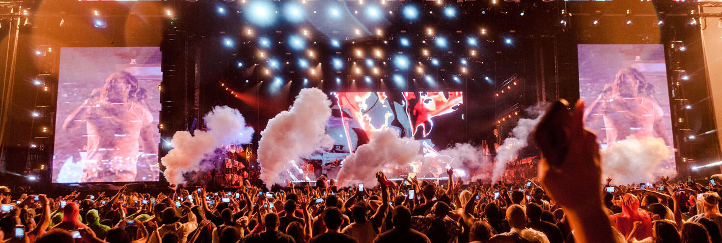
Rolling Loud
Centennial Parklands, Centennial Park
-
Start
12:00
Finish 22:00
Important Event Information
The Moore Park and Centennial Park precinct will be very busy on Saturday night with 20,000 music fans travelling to Rolling Loud as well as thousands of A-League fans attending a match at nearby Allianz Stadium in the evening.
Rolling Loud ticketholders are urged to plan ahead and catch public transport to avoid delays arriving and leaving the precinct as heavy traffic is expected.
- Festival tickets include travel on all modes of public transport, and extra light rail services will run to and from Moore Park. Plenty of regular route buses also make stops within walking distance along Oxford St and Anzac Pde nearby.
- Metro Trackwork: due to planned trackwork Sydney Metro services will not operate on Saturday. Buses replace services between Tallawong and Chatswood only. Use trains to travel between Epping or Chatswood and Sydenham. Plan your trip using the Trip Planner
- Drop offs & pick-ups:
- Drop offs: If you’re getting dropped off use the dedicated drop off zone in Centennial Park on Grand Drive east of Parkes Drive. Access into the Park will be via Robertson, Randwick, Woollahra and York Road gates.
- Pick ups: there is no dedicated pick up zone available on the vicinity of the park due to road closures in the evening. Please catch public transport or walk away from the event precinct to connect with rideshare/private vehicles faster as heavy traffic is expected. After 11pm, Driver Avenue will reopen for event pick-up, access from Moore Park Road only.
- Road closures will be in place from 8.30pm until midnight on sections on Driver Avenue, Lang Road and Moore Park Road to allow crowds to safely leave the festival.
- From 8.30pm access to the Entertainment Quarter will be via Moore Park Rd and Cook Road only, no access from Lang Rd at Anzac Pde or Oxford St due to road closures – follow signage and directions of traffic controllers, and expect traffic delays. From 10pm there will be no access to Entertainment Quarter until roads reopen at midnight. See the Rolling Loud Festival road closure and clearway map (pdf 676KB) for more details. You can find updates on real-time traffic conditions and road closures at livetraffic.com.
- Parking is available near Centennial Park at the Entertainment Quarter Wilson car park. A flat rate event parking fee will apply. Special event clearway parking restrictions will also be in effect on roads in the area so check signs carefully when parking to avoid being towed.
Valid pre-purchased tickets to Rolling Loud Festival on Saturday 7 March at Centennial Park include travel on the following transport services, just show your event ticket to transport staff when boarding services:
- Sydney Trains and NSW TrainLink Intercity services (non-booked services bounded by Bomaderry, Goulburn, Bathurst, Scone and Dungog stations)
- Sydney Metro services
- Sydney metropolitan and outer metropolitan buses
- Sydney and Newcastle Light Rail services
- Sydney, Parramatta and Newcastle Ferries
Remember to keep your event ticket safe for your return journey or you'll need to use your Opal card or contactless payment method, as you must have a valid ticket when travelling on public transport. Your event ticket is valid on the modes of public transport listed above until 4am the following day.
Note: an additional train station access fee applies for travel to or from Domestic and International Airport stations. The access fee is not covered by your event ticket travel entitlements.
Transport Park&Ride Car Parks
Park for free when you catch public transport. Transport Park&Ride provides up to 18 hours of free parking each day. All you have to do is complete a public transport trip. Located close to public transport hubs, Park&Ride car parks help you connect more easily to train, bus and ferry services.
Tickets to Rolling Loud Music festival include travel on transport and free Park&Ride parking. When leaving the car park use the intercom button at the exit gate to speak with the operator and show your event ticket.
Real-time parking availability allows you to see how many vacant car park spaces are available at Transport Park&Ride car parks.
For Park&Ride locations and more information on how it works, go to Transport Park&Ride.
Sydney Metro services are high-frequency, driverless trains running between Sydney’s north-west and south-west via the city.
M1 Metro North West & Bankstown Planned Trackwork – Saturday 7 to Sunday 8 March
- Metro services do not run between Tallawong and Sydenham.
- Buses replace services between Tallawong and Chatswood only.
- For travel to and from Waterloo use local buses or trains from Redfern.
- Use trains between Epping or Chatswood, the City and Sydenham
From the Moore Park light rail stop, walk to the festival via Federation Way and the Robertson Gates.
For Metro service disruption information, check trackwork and travel alerts or plan your trip using the Trip Planner.
The closest train stations to Centennial Park are Central and Bondi Junction.
From Central, catch a light rail service to Moore Park leaving from Chalmers Street to get within walking distance of the event.
From Bondi Junction, Centennial Park is a 10-minute walk via Grafton Street and Oxford Street. Alternatively, you can change for a regular route bus to Oxford Street at the Interchange.
Trackwork
Trackwork is taking place on Saturday 7 March on the following lines and may affect how you travel to and from the event. Plan ahead using the Trip Planner.
- M1 Metro North West & Bankstown Line: Metro services do not run between Tallawong and Sydenham. Buses replace services between Tallawong and Chatswood only. For travel to and from Waterloo use local buses or trains from Redfern. Use trains between Epping or Chatswood, the City and Sydenham
- City Circle: Trains do not run to Museum, St James or Circular Quay but continue to run between Central, Town Hall and Wynyard. Light rail services run between Central and Circular Quay. If travelling to Circular Quay, change at Wynyard for light rail or walk, or if travelling to Museum or St James, change at Central or Town Hall for local buses or walk. Trackwork also affects trains on other lines
- T1 Western Line: Richmond trains run to a changed timetable between Richmond and Liverpool. Change at Parramatta for trains towards the City. Penrith trains make an extra stop at Ashfield. From 6.30am to 10.30am, some Penrith trains make extra stops at Homebush and Burwood.
- T2 Leppington & Inner West Line: Buses replace trains between Leppington and Glenfield. Trains run to a changed timetable and stopping pattern between Macarthur and Central, platforms 1-14 via Granville or Regents Park, and between Homebush and North Sydney. Macarthur trains do not stop at Ashfield. You may need to change at Strathfield to continue your journey. Trains do not run around the City Circle. For travel to Circular Quay, St James or Museum use light rail or local buses. From 6.20am to 10.30am, buses replace Inner West trains between Ashfield and Central. T1 Western Line trains make extra stops at Homebush, Burwood and Ashfield. T9 Northern Line trains make extra stops at Croydon and Ashfield.
- T3 Liverpool & Inner West Line: Trains run to a changed timetable and stopping pattern between
:Macarthur and Central, platforms 1-14 via Granville or Regents Park, and between Homebush and North Sydney. Macarthur trains do not stop at Ashfield. You may need to change at Strathfield to continue your journey. Trains do not run around the City Circle. For travel to Circular Quay, St James or Museum use light rail or local buses. From 6.20am to 10.30am, buses replace Inner West trains between Ashfield and Central. T1 Western Line trains make extra stops at Homebush, Burwood and Ashfield. T9 Northern Line trains make extra stops at Croydon and Ashfield. - T4 Eastern Suburbs & Illawarra Line: All Cronulla and some Waterfall trains make extra stops at St Peters and Erskineville. From 3am to 11.30am, buses replace trains between Waterfall and Sutherland. Trains run to a changed timetable between Sutherland and Bondi Junction. Trains do not run around the City Circle. For travel to Circular Quay, St James or Museum use light rail or local buses. Buses replace T8 Airport & South Line trains. For travel to the Airport, change at Central or Sydenham for a bus, not Wolli Creek. Metro services do not run between Sydenham and Tallawong.
- T5 Cumberland Line: Buses replace trains between Leppington and Glenfield. Trains run between Liverpool and Schofields or Richmond, some to a changed timetable. Change trains at Liverpool to continue your journey towards Glenfield.
- T6 Lidcombe & Bankstown Line: Trains run to a changed timetable and reduced frequency, every 30 minutes.
- T8 Airport & South Line: Buses replace trains between Glenfield, Sydenham and Central via the Airport. Trains run to a changed timetable and stopping pattern between: Macarthur and Central, platforms 1-14 via Granville or Regents Park, and between Sydenham and Bondi Junction. Change at Central for trains to T4 Eastern Suburbs & Illawarra Line or South Coast Line stations, not Wolli Creek. Trains do not run around the City Circle. For travel to Circular Quay, St James or Museum use light rail or local buses.
- T9 Northern Line: From 6.30am to 10.30am, some trains make extra stops at Croydon and Ashfield.
- Central Coast & Newcastle Line: Sydney Metro trackwork may affect how you travel. Metro services do not run between Tallawong and Sydenham. Buses replace services between Tallawong and Chatswood only. For travel to T1 North Shore stations change at Hornsby, not Epping
- South Coast Line: From 3am to 11.30am, buses replace trains between Dapto, Port Kembla and Sutherland. Trains run to a changed timetable between Bomaderry, Kiama and Dapto, and T4 Illawarra trains run between Sutherland and Bondi Junction. The first train to South Coast Line stations leaves Bondi Junction at 10:13, Wollongong at 12:08, arriving Kiama at 12:52.
- Southern Highlands Line: The following trains leave Central earlier than the normal timetable: 16:06 Central to Moss Vale service leaves Central at 15:58, and 17:55 Central to Goulburn service leaves Central at 17:43.
Trackwork is carried out on an ongoing basis to maintain the safety, reliability, and efficiency of the Sydney Trains network. For train service disruption information, check trackwork and travel alerts or plan your trip using the Trip Planner.
Regular route buses
A number of regular buses make stops within walking distance of Centennial Park.
The closest stops to the Park are on Oxford Street near Lang Road or York Street.
- From the City: catch a route 333 bus that stops at Circular Quay, Hyde Park then continues towards Bondi via Oxford Street.
- From the Inner West: catch a route 352, 355 or 440 bus that makes stops along Oxford Street.
- From Bondi Junction: you can walk or catch a route 352, 355 or 440 bus that makes stops along Oxford Street.
Bus Diversions
Some stops on Oxford Street and the Moore Park Busway will be closed from 9pm to 11.30pm to allow crowds to safely leave the festival.
- Route 339 and 373: services that use the Moore Park Busway will use stops on Anzac Parade and Alison Road instead.
- Route 333, 352 and 440: services will miss stop St Matthias Anglican Church, Oxford Street (202150). Use the alternative stop at Paddington Public School, Oxford St (202151) instead.
For bus service disruption information, check travel alerts or plan your trip using the Trip Planner.
Private Coaches
Private coach parking will not be permitted at Centennial Park for the event. Use the following locations for drop-offs and parking/pick-ups.
- Drop-off: Driver Avenue or Parkes Drive south of Banksia Way.
- Parking/pick-up: Lee Street or Darling Drive. Patrons will travel to the city via Light Rail to meet their coaches at these locations
Catch one of the many ferry services to Circular Quay where you can change for a Route 333 bus to Oxford Street or a light rail service to Moore Park on the L2 and L3 lines to get within walking distance of Centennial Park.
For ferry service disruption information, check travel alerts or use the Trip Planner.
L1 Dulwich Hill Line
L1 Dulwich Hill Line light rail services run between Central Station (Grand Concourse) and Dulwich Hill via Darling Harbour and the Inner West. Services run regularly from 5am to 1am daily. Use the Trip Planner to plan your trip.
From Central, change for an L2 or L3 light rail service to Moore Park leaving from Chalmers Street. The festival is a short walk from the stop, via Federation Way and Robertson Road Gates.
L2 Randwick and L3 Kingsford Lines
L2 Randwick light rail services run between Circular Quay and Randwick via Central Station (Chalmers Street) and L3 Kingsford line services run between Circular Quay and Juniors Kingsford via Central Station (Chalmers Street). Services run regularly from 5am to 1am daily, plan your trip using Trip Planner.
Catch L2 or L3 light rail services to Moore Park. From the light rail stop, continue on foot towards Lang Road to enter Centennial Park via the Robertson Gates.
Additional light rail services will run before and after the game. Queues are expected, so be patient and allow plenty of extra time, particularly when leaving the stadium. Consider walking if able to (approximately 25-minutes) as light rail services will be very busy. See the Moore Park walking route map (pdf 677KB) to find your way.
On Saturday 7 March, train trackwork on the City Circle may affect how you travel. Trains do no run to Circular Quay but continue to run between Central, Town Hall and Wynyard. Use light rail services to Circular Quay. From 7am to 7pm, extra L2 and L3 light rail services run between Circular Quay and Randwick or Juniors Kingsford.
L4 Westmead and Carlingford Line
L4 Westmead and Carlingford Line light rail services run between Carlingford and Westmead via Parramatta CBD. Services run regularly from 5am to 1am daily. Plan your trip using the Trip Planner.
Alight at Parramatta Square and connect with trains to Central from Parramatta Station. From Central connect with L2/L3 light rail services from Chalmers St to Moore Park.
Passengers are reminded that trams can’t stop quickly or easily – so please stop, listen and look around for trams and use designated pedestrian crossings.
For maps and service frequencies see light rail service information. For light rail service disruption information, check travel alerts or plan your trip using the Trip Planner.
With around 20,000 music fans expected plus an additional 20,000 at an A-League match nearby, traffic will be heavy on roads around Moore Park and Centennial Park. Parking in the area is also extremely limited, so ticketholders are urged to catch public transport – event tickets include travel to and from Centennial Park.
If you must drive, expect delays on roads around and approaching Centennial Park and Moore Park, including on Anzac Parade, Lang Road, Oxford Street, Syd Einfeld Drive, Darley Road, York Road and Alison Road, as a large number of vehicle drop-offs and pick-ups are expected. Motorists should also exercise caution in the area as pedestrian activity on local roads will be higher than usual.
If you're getting picked up or catching taxis or rideshare home, be aware that access into the precinct will be affected by road closures on Moore Park Road and Lang Road. Access to the Entertainment Quarter will be managed via Cook Road only from 8.30pm, no access from Lang Rd at Anzac Pde or Oxford St due to road closures. From 10pm there will be no access to Entertainment Quarter until roads reopen at midnight.
Road Closures
The following roads will be closed in Centennial Park and Moore Park for the safety of crowds leaving the festival. See the Rolling Loud road closure and clearway map (pdf 676KB)for more details.
From 4.30pm to midnight
-
Driver Avenue between MacArthur Avenue (the southern turning circle) the NRL building (both sides)
From 8.30pm to midnight
- Driver Avenue between Lang Road and Peter Finch Avenue (northbound)
- Lang Road between Anzac Parade and Driver Avenue (eastbound)
- Lang Road* between Oxford Street and Mitchell Street (both directions) *Note: Managed access for residents maintained
- Moore Park Road between Oxford Street and Cook Road (westbound) – no access to the EQ precinct via Moore Park Road; access via Cook and Lang roads only.
From 10pm to midnight
- Cook Road between Darvall Street and Centennial Lane (southbound) - *Note: Managed access for residents maintained
- Driver Avenue between Moore Park Road and the NRL building (southbound)
- Eastern Distributor Bondi Exit – Bondi Exit onto Moore Road (eastbound)
- Lang Road between Cook Road and Darvall Street (westbound) - *Note: Managed access for residents maintained
- Lang Road between Cook Road and Errol Flynn Boulevard (westbound)
- Moore Park Road between Oatley Road and Oxford Street (eastbound)
- Renny Street between Oatley Road and Renny Lane (eastbound) - *Note: Managed access for residents maintained
- Robertson Road between Lang Road and Martin Road (both directions) - *Note: Managed access for residents maintained when safe to do so
- Stewart Street between Oatley Road and Alexander Street (eastbound) - *Note: Managed access for residents maintained
Entertainment Quarter access:
From 8.30pm to 10pm access to the Entertainment Quarter will be via Moore Park Rd and Cook Road only, no access from Lang Rd at Anzac Pde or Oxford St due to road closures. Vehicle access will be permitted via Moore Park Rd eastbound only (under traffic management) and Cook Rd - follow signs and directions of traffic controllers
From 10pm there will be no access to Entertainment Quarter until roads reopen at midnight.
For more details on the road closures and the latest traffic information visit Live Traffic NSW or download a real-time traffic app.
Private Coaches
Private coach parking will not be permitted at Centennial Park for the event. Use the following locations for drop-offs and parking/pick-ups.
- Drop-off: Driver Avenue or Parkes Drive south of Banksia Way.
- Parking/pick-up: Lee Street or Darling Drive. Patrons will travel to the city via Light Rail to meet their coaches at these locations
After the event, patrons will need to exit the venue following sign to Driver Avenue, past ride share pickup area to where coaches are parking on the northern side of Driver Avenue.
Moore Park Car Parks
Limited parking is available nearby at the Entertainment Quarter Wilson Car Park (parking rates apply, open 24 hours). Mobility Parking permit holders can utilise accessible parking spaces.
Be aware that exit from car parks may be delayed until festival crowds have safely cleared the precinct, be patient and allow extra travel time heading home.
For more parking information visit the Entertainment Quarter website.
Special Event Clearways
Special event clearways will be in effect on roads in and around Moore Park from 11am to 11.30pm on sections of Fitzroy Street, Lang Road and Oxford Street, and from 6am to 11.30pm on sections of Cleveland Street. Driver Avenue will also have clearways in effect all day.
From 12:01am to 11.59pm:
-
Driver Avenue between Lang Road and Moore Park Road (both sides)
From 6am to 11.30pm
- Cleveland Street between South Dowling Street and City Road (southern side)
- Cleveland Street between Abercrombie Street and South Dowling Street (northern side)
From 11am to 11.30pm
- Albion Street between Bourke Street and Flinders Street (both sides)
- Fitzroy Street between South Dowling Street and Bourke Street (northern side)
- Lang Road between Anzac Parade and Errol Flynn Boulevard (northern side)
- Oxford Street between Queen Street and Jersey Road (southern side)
- Oxford Street between Queen Street and Victoria Avenue (northern side)
Clearways are strict no-parking zones for all vehicle types, and apply even to local residents and TfNSW Mobility Scheme Permit holders. Check signs carefully as vehicles left in clearways will be towed and a fee applies. If your vehicle is towed, you can search your vehicle registration at the Find My Car website to find its new location, or alternatively call 132 701 to speak to an operator.
Visit Live Traffic NSW for more details and real-time traffic conditions.
Transport Park&Ride Car Parks
Park for free when you catch public transport. Transport Park&Ride provides up to 18 hours of free parking each day. All you have to do is complete a public transport trip. Located close to public transport hubs, Park&Ride car parks help you connect more easily to train, bus and ferry services.
Tickets to Rolling Loud Music festival include travel on transport and free Park&Ride parking. When leaving the car park use the intercom button at the exit gate to speak with the operator and show your event ticket.
Real-time parking availability allows you to see how many vacant car park spaces are available at Transport Park&Ride car parks. For Park&Ride locations and more information on how it works, go to Transport Park&Ride.
Accessible trips are shown in the Trip Planner with the wheelchair icon. You can select "accessible services only" in the Options to ensure you only see accessible services. Only trip plans with accessible train platforms, ferry wharves and buses will be presented. See accessible travel or download a transport app (select the "Accessibility" filter).