Sandbox Festival
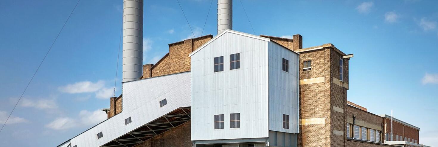
White Bay Power Station
-
Start
14:00
Finish 23:00
Important travel advice
Large crowds are expected to attend the Sandbox Festival at White Bay Power Station. Festivalgoers are encouraged to plan ahead and consider the public transport options available.
Regular route buses 441 and 442 stop outside the venue on Robert Street. A number of buses also stop along Victoria Road, which is within short walking distance of the event.
The closest light rail stop to the venue is Rozelle Bay on the L1 Line from there you can walk across the Green Link bridge over towards the venue, or connect with buses leaving from The Crescent to get within closer walking distance of White Bay Power Station from Victoria Road.
Remember, you'll need to use an Opal card or contactless payment card/device when travelling on public transport to and from the event. Register your details online at Opal or via the Opal Travel app ahead of time.
Parking in the area is limited so if you must drive plan ahead. You can find real-time updates on traffic conditions at livetraffic.com.
Opal
You can use an Opal card for all modes of public transport in Sydney and surrounding regions, including metro, trains, buses, ferries and light rail.
Remember to top up your Opal card before you travel to avoid waiting in line at top-up machines. You can top up your card online or at an Opal retailer.
More ways to pay
If you have a contactless-enabled American Express, Mastercard or Visa debit or credit card, or a linked device, you can use it to pay for your travel by tapping on and tapping off at Opal card readers. Available on all public transport, contactless payments are another way to pay on the Opal network. Adult Opal fare pricing applies and you will receive Opal benefits, including daily and weekly fare caps.
Sydney Metro services are high-frequency, driverless trains running between Sydney’s north-west and south-west via the city.
The M1 Metro North West & Bankstown Line operates turn up-and-go Metro services in both directions between Tallawong, Chatswood and Sydenham.
Change at Gadigal or Central to connect with bus services towards Rozelle.
Extra metro services will run between Tallawong and Sydenham due to train trackwork on the T1 North Shore Line.
For Metro service disruption information, check trackwork and travel alerts or plan your trip using the Trip Planner.
The best station for connections to White Bay Power Station is Town Hall.
Connect with route 441 and 442 buses from QVB York Street, which stop outside the venue. Alternatively, you can connect with services towards Rozelle from Central to get within short walking distance of the event.
Trackwork
Planned trackwork is taking place on Saturday 19 September on the following lines and may affect how you travel to and from the event. Plan ahead using the Trip Planner.
- T1 North Shore Line: Buses replace trains between Hornsby and Milsons Point, also stopping at Crows Nest and Victoria Cross metro stations. Use metro services between Chatswood and the City, or ferry services between Milsons Point and Circular Quay.
- T1 Western Line: Trains run to a changed timetable and stopping pattern between Richmond and Olympic Park. You may need to change trains at Parramatta or Granville to continue your journey. Trains also run to a changed timetable and stopping pattern between Penrith and Central, platforms 1-14 only.
- T8 Airport & South Line: From 9am to 3pm, trains may run to a changed timetable due to trackwork between Revesby and Turrella
- T9 Northern Line: Trains run between Berowra or Hornsby and Central, platforms 1-14 only. If travelling to T1 North Shore Line stations, change at Epping or Central for metro services to Victoria Cross, Crows Nest or Chatswood, then change for a bus
Trackwork is carried out on an ongoing basis to maintain the safety, reliability, and efficiency of the Sydney Trains network. For train service disruption information, check trackwork and travel alerts or plan your trip using the Trip Planner.
Plenty of route buses run regularly to Rozelle and stop within walking distance of the venue.
Regular route buses 441 and 442 start from QVB, York St Stand B and drop off on Robert Street opposite the venue. A number of other bus routes also stop along Victoria Road, within short walking distance of the venue.
For bus service disruption information, check travel alerts or plan your trip using the Trip Planner.
Catch one of the many ferry services to Balmain East or Birchgrove where you can connect with route buses to get within walking distance of the event.
Route 441 buses run from Birchgrove Wharf and route 442 buses run from Balmain East Wharf. Both services drop-off on Robert Street, opposite White Bay Power Station.
Keep in mind that Sydney ferry services are popular and may reach capacity, particularly on weekends. Plan your trip and allow plenty of extra travel time or consider the alternative public transport options available.
For ferry service disruption information, check travel alerts or plan your trip using the Trip Planner.
L1 Dulwich Hill Line
L1 Dulwich Hill Line light rail services run between Central Station (Grand Concourse) and Dulwich Hill via Darling Harbour and the Inner West. Services run regularly from 5am to 1am daily. Plan your trip using the Trip Planner.
The closest stop to the venue is Rozelle Bay. From there, you can walk across Rozelle Parklands via the Green Link bridge or connect with buses leaving from The Crescent to get within walking distance of White Bay Power Station from Victoria Road.
L2 Randwick and L3 Kingsford Lines
L2 Randwick Line light rail services run between Circular Quay and Randwick via Central Station (Chalmers Street) and L3 Kingsford Line services run between Circular Quay and Juniors Kingsford via Central Station (Chalmers Street). Services run regularly from 5am to 1am daily. Plan your trip using Trip Planner.
Catch a service to QVB to connect with buses towards Rozelle. Alternatively, change at Central or Chinatown (Capitol Square) to an L1 Line services to Rozelle Bay to get within walking distance of White Bay Power Station.
L4 Westmead and Carlingford Line
L4 Westmead and Carlingford Line light rail services run between Carlingford and Westmead via Parramatta CBD. Services run regularly from 5am to 1am daily. Plan your trip using the Trip Planner.
Alight at Parramatta Square and connect with a train to Central from Parramatta Station. From Central, catch L1 light rail services or buses towards Rozelle to get within short walking distance of the event.
Passengers are reminded that trams can’t stop quickly or easily – so please stop, listen and look around for trams and use designated pedestrian crossings.
For maps and service frequencies see light rail service information. For light rail service disruption information, check travel alerts or plan your trip using the Trip Planner.
Allow extra travel time as traffic in the area may be heavier than usual as festivalgoers travel to and from the event. Parking in the area is also limited so if you have to drive, carpool with your group and arrive early to find local parking. You can find real-time updates on traffic conditions at livetraffic.com.
For the latest traffic information visit Live Traffic NSW or download a real-time traffic app.
Parking in the area is limited. If you have to drive, allow extra travel time, carpool with your group and arrive early to find nearby local parking.
Accessible trips are shown in the Trip Planner with the wheelchair icon. You can select "accessible services only" in the Options to ensure you only see accessible services. Only trip plans with accessible train platforms, ferry wharves and buses will be presented. See accessible travel or download a transport app (select the "Accessibility" filter).