Spring Cycle
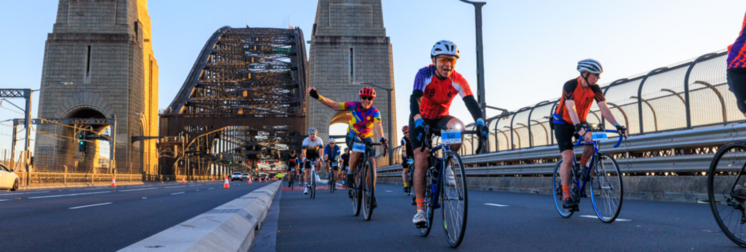
North Sydney to Parramatta Park via Pyrmont
-
50km Classic Ride
06:30
10km City Ride 08:00
City Ride finish at Pirrama Park, Pyrmont 11:00
Classic 50km ride finish at Parramatta Park 13:00
Important event information
Thousands of participants will cycle from North Sydney to Parramatta Park via Pyrmont on a 10km or 50km course. Road closures will be in place along the first 10km to Pyrmont including lanes on the Harbour Bridge, from there cyclists int he 50km ride will continue on to Parramatta Park sharing roads with motorists and abiding by general road rules.
Transport
- Travel on trains, metro and ferries is free for participants and volunteers. Simply show your travel pass, rider bib or volunteer t-shirt to transport staff when boarding services. Free travel is also approved for volunteers travelling without bicycles on buses and light rail services.
- Getting to the start line:
- Trains are the best mode of transport for participants travelling with their bikes, extra early morning trains will run. The closest station to the start line is North Sydney which is a short ride from St Leonards Park.
- Metro services run regularly to Victoria Cross which is a short ride from the start area – note that access to street level is via lifts only so allow extra time as there may be queues.
- Getting home
- From the city ride finish area at Pyrmont, plenty of transport services are within short walking or riding distance including Central, Wynyard and Town Hall. Light rail services nearby are expected to reach capacity quickly so riders are encouraged to continue towards Central or Town Hall for a faster connection.
- From the 50km ride finish area in Parramatta Park, trains towards the city will be affected by trackwork between Parramatta and Olympic Park.
- If you are travelling home towards the city/north shore - ride to Olympic Park station (approx 10km) to connect with trains towards the city which will run frequently.
- Alternatively catch T5 Line trains from Westmead or Parramatta to Glenfield to connect with T8 Line trains to the city (please note this will add approx 45min to your trip).
- If you are travelling towards the west exit the park at Queen St gate, walk/ride to Westmead Station to connect with trains.
- Trackwork:
- Planned trackwork is taking place with buses replacing trains between Parramatta and Olympic Park which may affect how you travel to and from the event. Bikes are not permitted on board replacement buses due to limited space.
- Bikes on transport: Bicycles cannot be carried on buses and will only be permitted on ferries and light rail services at the discretion of the crew or drivers if there is safe space available. Ferry services are very popular on weekends and can reach capacity quickly so capacity for bikes may be limited.
- Learn more about travelling on public transport with bikes.
Driving and road closure
- Major roads from North Sydney to Pyrmont will be closed from 4am including the Cahill Expressway and sections of the Western Distributor. All roads reopen by 11.30am. From Pyrmont, cyclists will continue on the remainder of the course to Parramatta Park sharing roads with motorists and abiding by general road rules.
- Special event clearways will be in effect on roads along sections of the course in North Sydney, Millers Point and Pyrmont between 3am and 11am and in Five Dock/Concord/Wareemba between 5am and 11am. Clearways are strict no-parking zones for all vehicle types, check signs carefully to avoid being towed.
Stay connected
Stay connected and get real-time updates on the event, transport services, traffic and road closures:
- Event updates follow @SpringCycle on X (Twitter) and on Facebook.
- Transport updates: follow @TrainsInfo, @BusesInfo, @FerriesInfo and @SydneyMetro
- Road closures and traffic: follow Live Traffic NSW Facebook page.
- Check the Interactive Road Closure Map (coming soon) to easily view road closure and special event clearway locations along the route.
Event travel entitlements
Travel on train, metro and ferry is free for Spring Cycle 2026 participants and volunteers travelling to and from the event on Sunday 11 October. Show your rider bib number or volunteer free travel pass to transport staff when boarding the following services.
- Sydney Trains and NSW TrainLink Intercity services (non-booked services bounded by Bomaderry, Goulburn, Bathurst, Scone and Dungog stations)
- Sydney Metro services
- Sydney and Newcastle Ferries
Free travel is also approved for volunteers travelling without bicycles on Sydney buses and Light Rail services.
** Bus drivers, ferry crews and light rail operators reserve the right to refuse bikes on-board services if there is not enough room for bikes to be safely stowed or other general public safety concerns. Learn more about travelling on public transport with bikes.
Remember to keep your rider number or volunteer pass safe for your journey back home or you’ll need to use an Opal card, as you must have a valid ticket when travelling on public transport.
Note: an additional train station access fee applies for travel to or from Domestic and International Airport stations. Your travel entitlement does not cover the access fee.
Transport Park&Ride Car Parks
Park for free when you catch public transport. Transport Park&Ride provides up to 18 hours of free parking each day. All you have to do is complete a public transport trip. Located close to public transport hubs, Park&Ride car parks help you connect more easily to train, bus and ferry services.
Spring Cycle 2026 participants and volunteers have free travel on metro, trains and ferries, and free Park&Ride parking. When leaving the car park use the intercom button at the exit gate to speak with the operator and show your event ticket.
Real-time parking availability allows you to see how many vacant car park spaces are available at Transport Park&Ride car parks. For Park&Ride locations and more information on how it works, go to Transport Park&Ride.
Opal
You can use an Opal card for all modes of public transport in Sydney and surrounding regions, including metro, trains, buses, ferries and light rail.
Remember to top up your Opal card before you travel to avoid waiting in line at top-up machines. You can top up your card online or at an Opal retailer.
More ways to pay
If you have a contactless-enabled American Express, Mastercard or Visa debit or credit card, or a linked device, you can use it to pay for your travel by tapping on and tapping off at Opal card readers. Available on all public transport, contactless payments are another way to pay on the Opal network. Adult Opal fare pricing applies and you will receive Opal benefits, including daily and weekly fare caps.
Sydney Metro services are high-frequency, driverless trains running between Sydney’s north-west and south-west via the city.
The closest metro station to the start line is Victoria Cross. Cyclists can use the North or South exits.
From Victoria Cross Station – exit via Miller Street North, then turn right heading north on Miller St until you reach St Leonards Park. From the Miller Street South exit, event marshals will manage the safe crossing of riders across Miller St to continue in the northbound lanes up Miller St to reach the start line near St Leonards Park
Alternatively, you can also use Crows Nest Metro station. Signage will direct riders to the start area via Clarke St, Willoughby Rd, Burlington St, West St and Carlow St.
Travelling with bikes on metro services:
Be aware that access to street level from both Victoria Cross and Crows Nest Metro Stations is via lifts only so please be patient and allow additional time to reach street level as there may be long queues. It is not permitted to travel on escalators with bikes.
For Metro service disruption information, check trackwork and travel alerts or plan your trip using the Trip Planner.
Getting there
The closest station to the starting line in St Leonards Park is North Sydney on the T1 North Shore Line. The start area is a short ride from the station via Miller St.
Trains to North Sydney run every 15 minutes on weekends. Some additional trains will also run:
- Additional early morning all-stops services on the City Circle will leave from Campbelltown at 5:50am via East Hills and Sydenham and from Cronulla at 6:15am.
- If you are travelling to the start line at North Sydney by train, stay on train services and do not switch to metro where possible.
- Planned trackwork is taking place between Parramatta and Olympic Park which may affect how you travel to the event. Be aware bikes cannot be taken onboard replacement buses.
Getting home
10km City Ride participants:
- If you’re taking part in the 10km City Ride, you’ll finish at Pirrama Park in Pyrmont.
- The closest train stations are Central, Wynyard and Town Hall which are a short ride (or walk) through the city. Alternatively, you can travel home on a Light rail service from Pyrmont.
- Remember you’ll no longer be travelling on the event course so take extra care, especially when crossing roads.
50km Classic Ride participants:
- Planned trackwork is taking place with buses replacing trains between Parramatta and Olympic Park which may affect how you travel to and from the event. Bikes are not permitted on board replacement buses due to capacity limitations.
- If you are travelling towards the west exit the park at Queen St gate, walk/ride to Westmead Station to connect with trains
- If you are travelling home towards the city/north shore - ride to Olympic Park station (approx 10km) to connect with trains towards the city which will run frequently
- Alternatively catch T5 Line trains from Westmead or Parramatta to Glenfield to connect with T8 Line trains to the city (please note this will add approx 45min to your trip).
If you’ve still got the energy to ride home, make sure to choose a route that avoids riding against the thousands of other cyclists still taking part in the event. To find a safe route home check out the cycleway mapping resources at Bicycle Info.
Trackwork
Planned trackwork is taking place on Sunday 11 October on the following lines that may affect how you travel to and from the event. Plan ahead using the Trip Planner.
Detailed trackwork information will be available closer to the event date.
Trackwork is carried out on an ongoing basis to maintain the safety, reliability and efficiency of the Sydney Trains network. Trackwork may affect how you travel to and from events. For the latest information, check trackwork service updates or use the Trip Planner.
Participants travelling with their bikes are reminded that bikes are not permitted on buses or train replacement bus services, including Southwest Link buses between Sydenham and Bankstown. This is because bikes are difficult to stow and may pose a safety risk or inconvenience other passengers. Consider the alternative transport options including trains and metro services which have more capacity.
Buses to North Sydney run from the early morning however services will be diverting around road closures so factor in extra travel time if arriving by bus to the start line. Buses will run to a regular Sunday timetable.
Bus diversions
Buses in North Sydney, the Sydney CBD and Pyrmont will be diverting from their regular routes and using temporary stops while roads are closed for the event between 4am and 11.30am:
- Route 115: From 4am to 10:30am, buses towards North Sydney will end trips at North Sydney Station, Blue St, Stand F (Stop ID 206015). Buses towards Chatswood will start trips from Greenwood Plaza, Pacific Hwy (Stop ID 206027). Stops on Miller St and Blue St will be missed due to road closures in North Sydney.
- Routes 202, 207 and 208: From 4am to 10:30am, buses will travel through North Sydney via Ernest St or Falcon St and Pacific Hwy in both directions. Stops on Miller St between Falcon St and Pacific Hwy as well as Blue St will be missed due to road closures in North Sydney. Buses will continue to run to and from the city but will detour via York St or Clarence St in both directions due to road closures in the CBD.
- Route 230: services to and from Milsons Point will travel through North Sydney via Falcon St and the Pacific Hwy, missing some stops on Miller St due to road closures.
- Route 252: From 4am to 10:30am, buses towards North Sydney will end trips at North Sydney Station, Blue St, Stand F (Stop ID 206015). Buses towards Gladesville will start trips from Greenwood Plaza, Pacific Hwy (Stop ID 206027). Stops on Miller St and Blue St will be missed due to road closures in North Sydney.
- Route 261: From 4am to 10:30am, buses towards North Sydney will end trips at North Sydney Station, Blue St, Stand F (Stop ID 206015). Buses towards Lane Cove will start trips from Greenwood Plaza, Pacific Hwy (Stop ID 206027). Stops on Miller St and Blue St will be missed due to road closures in North Sydney
- Routes 254 and 291: From 4am to 10:30am, buses towards McMahons Point will divert around a section of Miller St via Pacific Hwy. Buses towards Riverview and Epping will divert around a section of Miller St via Blue St and Pacific Hwy and will make an additional stop at Greenwood Plaza, Pacific Hwy (Stop ID 206027). Some stops on Miller St will be missed due to road closures in North Sydney.
- Route 263: services to the city will end on Pitt St near Spring St instead of Bridge St due to closures on the Cahill Expressway. Services leave the city from regular stops.
- Routes N90 and N91: From 4am to 9:30am (last service), buses towards the city will run as normal. Buses towards Hornsby and Macquarie Centre will divert around Blue St via Pacific Hwy and will make an additional stop at Greenwood Plaza, Pacific Hwy (Stop ID 206027). The stop on Blue St will be missed due to road closures in North Sydney
- Routes 288 and 292: From 4am to 11am, buses towards the city will end trips at Wynyard Station, York St, Stand N (Stop ID 200036). Buses towards Macquarie Uni and Marsfield will start trips from Wynyard Station, Clarence St, Stand R (Stop ID 2000142). Some stops on Sussex St and Clarence St will be missed due to road closures in the CBD.
- Routes 311, 324 and 325: From 3:30am to 11am services will not run to or from Walsh Bay/Millers point due to road closures on Hickson Rd. Services to the city will end on Park St, Town Hall, Stand J. Services to Watsons Bay start from QVB at York St, Stand A. Stops on Kent St and Hickson Rd will be missed.
- Route 343: services in both directions will make alternate stops on Pacific Hwy at Greenwood Plaza / Miller St due to closures on Blue St.
- Routes 437, 441 and 442: services to the city will miss the stop on Sussex St after King St (Stop ID 2000228) due to road closures. Alight the bus at QVB Market St Stand F instead.
From 4am to 11.30am:
- Route 389: services in both directions will start and end trips on Harris St opp John Street Square Light Rail (Stop ID 200923). Some stops on Pirrama Rd, Harris St and surrounding streets will be missed.
Check if your bus service is affected before heading out for the day. You can search your route number in travel alerts or use the Trip Planner.
Sydney Ferries are a great way to get around the city, but services are very popular and may reach capacity, especially on Sundays. The closest wharf to the start area is Milsons Point however depending on which event you are participating in, ferries may not operate early enough to get you to the start area on time.
Travel on ferries with bikes
We don’t recommend travel on ferries for Spring Cycle participants travelling with their bikes as ferry crews reserve the right to refuse bikes on-board vessels if there is not enough room for it to be safely stowed or other general public safety concerns. Learn more about travelling on public transport with bikes.
If you intend on travelling by ferry to or from the event make sure to have an alternate transport option in mind.
For ferry service disruption information, check travel alerts or plan your trip using the Trip Planner.
Bikes are permitted on board Light rail services, however staff may restrict the number of bicycles allowed on-board or refuse access when carriages are crowded. Make sure your bike is safely stowed and locked, away from doors at all times. When on light rail platforms, walk with your bikes, do not ride your bike along the platform. Learn more about travelling on public transport with bikes.
L1 Dulwich Hill Line
L1 Dulwich Hill Line light rail services run between Central Station (Grand Concourse) and Dulwich Hill via Darling Harbour and the Inner West. Services run regularly from 5am to 1am daily. Plan your trip using the Trip Planner.
Change at Central to connect with T1 North Shore Line trains to North Sydney to get within riding distance of the start line.
If you’re taking part in the 10km City Ride which finishes at Pirrama Park, ride to Town Hall or Central stations to continue your trip home as light rail services will be unable to accommodate the volume of bikes leaving from the finish area. Remember you’ll no longer be travelling on the event course so take extra care, especially when crossing roads.
L2 Randwick and L3 Kingsford Lines
L2 Randwick light rail services run between Circular Quay and Randwick via Central Station (Chalmers Street) and L3 Kingsford line services run between Circular Quay and Juniors Kingsford via Central Station (Chalmers Street). Services run regularly from 5am to 1am daily. Plan your trip using the Trip Planner.
Catch L2 or L3 light rail services to CBD stops to connect with T1 North Shore Line trains to North Sydney to get within riding distance of the start line.
L4 Westmead and Carlingford Line
L4 Westmead and Carlingford Line light rail services run between Carlingford and Westmead via Parramatta CBD. Services run regularly from 5am to 1am daily. Plan your trip using the Trip Planner.
Trackwork is taking place on the Sydney Trains network between Parramatta and Olympic Park. Catch trains to Glenfield to connect with trains to the city.
Passengers are reminded that trams can’t stop quickly or easily – so please stop, listen and look around for trams and use designated pedestrian crossings.
For maps and service frequencies see light rail service information. For light rail service disruption information, check travel alerts or plan your trip using the Trip Planner.
Road closures will be in place along the first 10km of the ride from North Sydney to Pyrmont, from there cyclists int he 50km ride will continue on the remainder of the course to Parramatta Park sharing roads with motorists abiding by general road rules.
Plan your movements ahead of time and refer to our Spring Cycle 2026 interactive map (coming soon) to see the route, road closures and clearways across the course.
Key road closures
- North Sydney
- 4am to 10.30am: Miller St between Falcon St and Pacific Hwy, Berry St from Pacific Hwy to Walker St.
- 4am to 11am: Little Walker St and Arthur St
- Local roads off Berry St will be closed from 6am to 9.30am. The westbound lane on Blue St at North Sydney Station will close from 4am to 9.30am.
- Cahill Expressway & Sydney Harbour Bridge
- 4am to 10:30am: Lanes 7 and 8 on the Sydney Harbour Bridge including Mount St and High St on-ramps. Lanes 3 and 6 will be closed on the Sydney Harbour Bridge deck – two lanes will remain open in both directions. A 40km/h speed limit will be in effect while riders share lanes on the bridge.
- 4am to 11am: Cahill Expressway Circular Quay Overpass in both directions including on and off-ramps to Macquarie St
- Sydney CBD, Millers Point, The Rocks
- 4am to 10.30am: sections of Upper Fort St and Watson Rd, Grosvenor St on-ramp to Harbour Bridge.
- 4am to 10.15am: sections of Towns Place, Dalgety Rd, Argyle St
- 4am to 11am: Hickson Rd southbound from Towns Place to Erskine St, Napoleon St westbound, King St from Sussex St and full closure of Sussex St between King St and Erskine St.
- Western Distributor from Pyrmont to the City
- 4am to 11.15am – closed from Pyrmont on-ramp to City North off-ramp at King St. Motorists travelling citybound from the Anzac Bridge will be diverted via the Bathurst St off-ramp where they can re-join the Harbour Bridge via Harbour St or Kent St.
- Darling Harbour and Pyrmont
- 4am to 11.15am: sections of Pyrmont St, Pyrmont Bridge Rd, Murray St, Union St, Bunn St and other local roads.
- 4am to 11:30am: section of Pirrama Rd at Murray St /Darling Dr
- 7am to 11.30am: sections of Pirrama Rd and Harris St.
- Ultimo
- 6am to 10am: sections of Kelly St and Wattle St left-turn lane from Broadway (access to Wattle St maintained from Broadway intersection).
- Annandale
- 4am to 11:15am: Chapman Rd will be closed at The Crescent.
- Parramatta Park
- 6am to 2pm: local roads inside the park will be closed to vehicles to safely facilitate the event and participants at the finish line.
Cycleway closures
Cycleway closures affect both directions unless stated otherwise.
- Pyrmont from 4am to 11am: Union Street between Edward Street and Murray Street (eastbound)
For a detailed listing of the special event clearway times and locations including downloadable PDF maps, visit Live Traffic NSW.
Parking
North Sydney: street and paid parking around the start area in St Leonards Park will be in high demand. Special event clearway parking restrictions will also be in place on roads in North Sydney. Keep in mind roads will be closed until 11am in North Sydney so access to some parking areas will be restricted until roads reopen. If you plan to drive make sure to arrive early. Visit North Sydney Council for local parking options.
Pyrmont: street and paid parking around the finish area in Pirrama Park is limited and street parking restrictions apply. Keep in mind roads will be closed until 11.30am in Pyrmont so access to parking will be restricted until roads reopen. Visit the City of Sydney parking meter map for street-parking options.
Parramatta Park: Visit City of Parramatta – Parking for more information on available parking locations near the park. Please note Parramatta Park will be closed to vehicles from 6am to 2pm on Sunday 11 October.
Special event clearways
Special event clearway parking restrictions will be in effect on roads along and surrounding the course between 3am and 11am.
- North Sydney - from 3am to 11am on sections of Miller St, Berry St, Arthur St and Carlow St.
- Sydney CBD, Millers Point, Pyrmont and Ultimo - from 3am to 11am on sections of Upper Fort St, Dalgety Rd, Towns Place, Erskine St, Sussex St, Wattle St and Pyrmont St.
- Five Dock, Concord, Wareemba and Canada Bay - from 5am to 11am on sections of Lyons Rd West, Crane St, Hampden Ave and First Ave.
Clearways are strict no-parking zones, and apply even to residents with local council parking permits or RMS Mobility Scheme Permit holders. Check signs before parking as vehicles left in special event clearways will be towed and a towing fee applies.
Plan your movements ahead of time and refer to our Sydney Spring Cycle 2025 interactive map highlighting the road closures and clearways.
For a detailed listing of the special event clearway times and locations including downloadable PDF maps, visit Live Traffic NSW.
Transport Park&Ride Car Parks
Park for free when you catch public transport. Transport Park&Ride provides up to 18 hours of free parking each day. All you have to do is complete a public transport trip. Located close to public transport hubs, Park&Ride car parks help you connect more easily to train, bus and ferry services.
Spring Cycle 2026 participants and volunteers have free travel on metro, trains and ferries, and free Park&Ride parking. When leaving the car park use the intercom button at the exit gate to speak with the operator and show your event ticket.
Real-time parking availability allows you to see how many vacant car park spaces are available at Transport Park&Ride car parks. For Park&Ride locations and more information on how it works, go to Transport Park&Ride.
Due to road closures for the event some taxi ranks will be affected
North Sydney: The taxi rank on the station side of Blue St in North Sydney will not operate due to road closures until 9.30am. Taxi ranks on Miller St will also be affected while roads are closed until 10.30am.
Other taxi ranks within the road closure footprint in the city and Pyrmont will not be accessible.
For details of taxi networks servicing the Sydney area, visit Transport Operators.
Accessible trips are shown in the Trip Planner with the wheelchair icon. You can select "accessible services only" in the Options to ensure you only see accessible services. Only trip plans with accessible train platforms, ferry wharves and buses will be presented. See accessible travel or download a transport app (select the "Accessibility" filter).