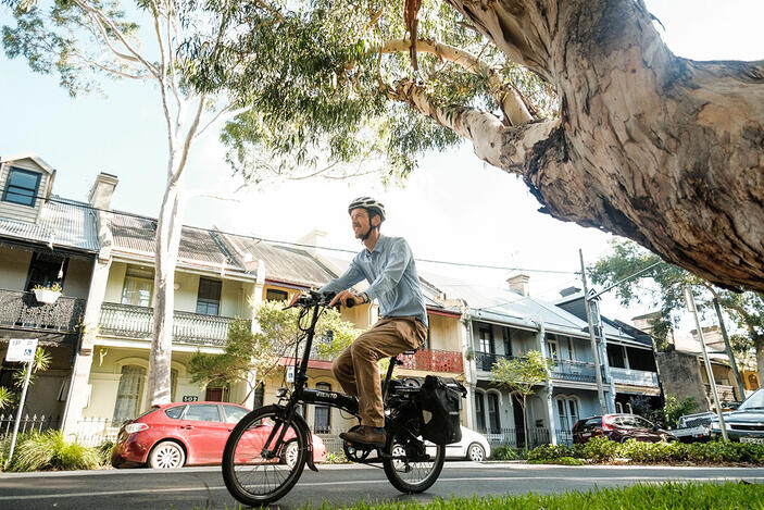
Bike riding

Cycleways and shared paths
Strap on your helmet! Ride the cycleways and shared paths making it easier and safer to ride around Sydney.
Use the Trip Planner or Cycleway Finder to find routes near you.
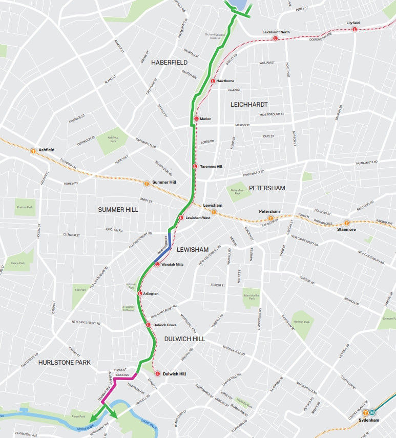
Campsie to Tempe via Canterbury and Hurlstone Park
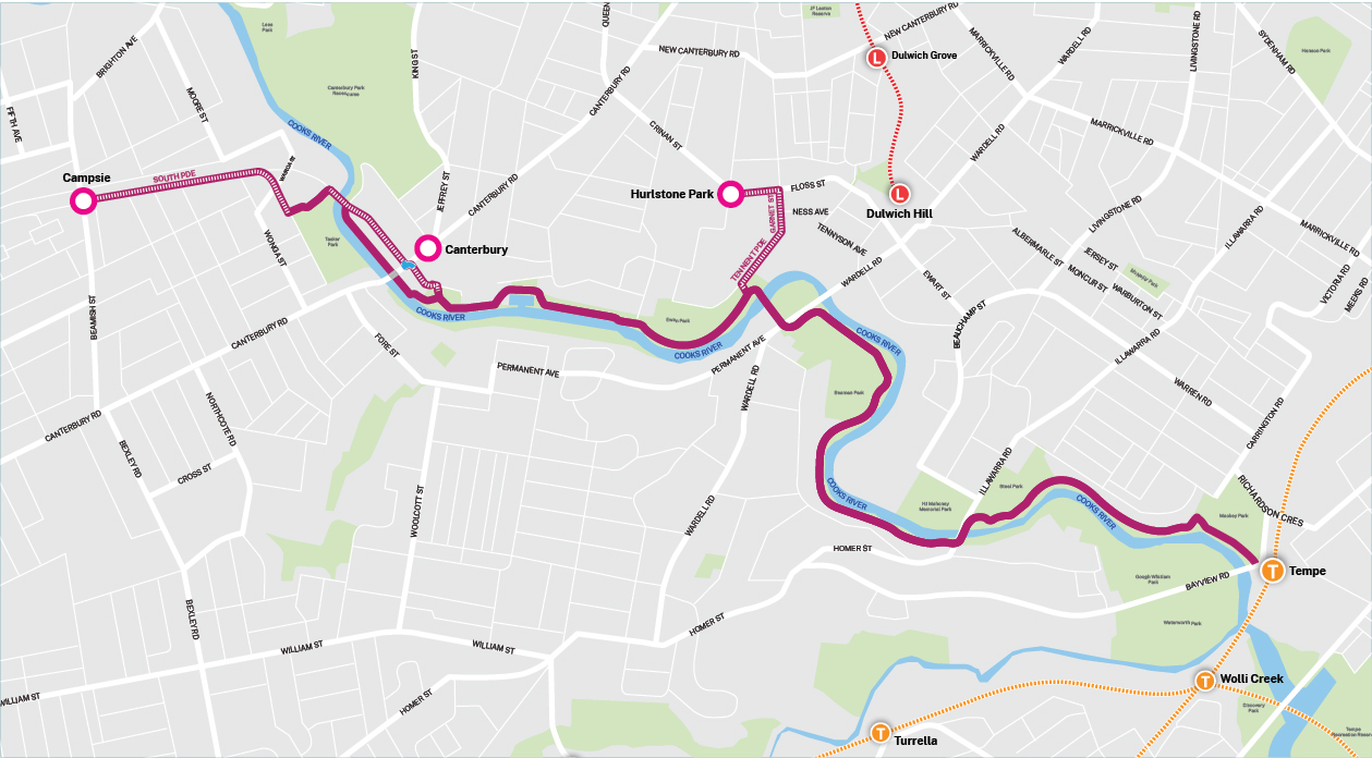
Download the Campsie to Tempe via Canterbury and Hurlstone Park map (pdf 760KB)
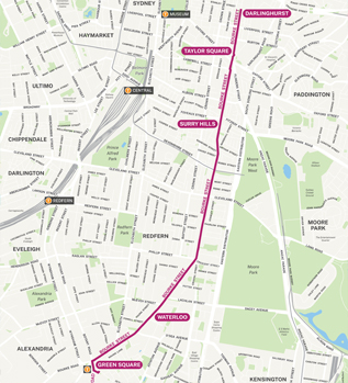
Dulwich Hill and Marrickville to Redfern
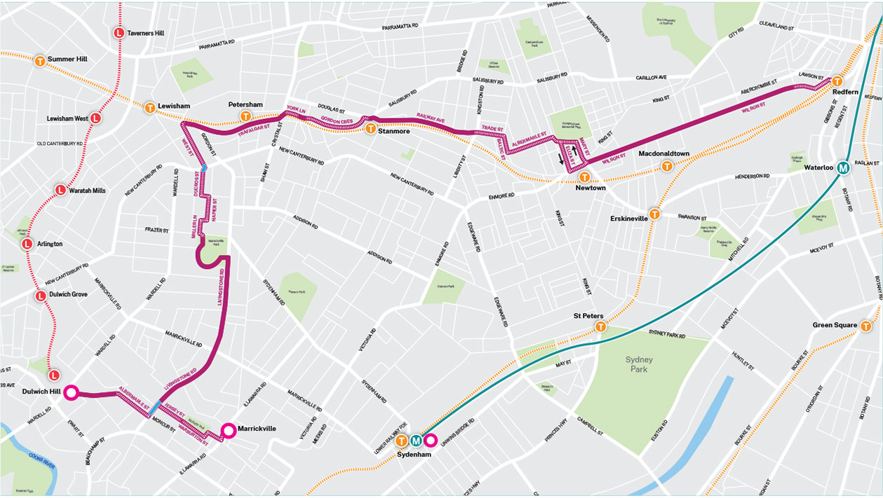
Download Dulwich Hill and Marrickville to Redfern map (pdf 770KB)
Hurlstone Park to Sydenham via Dulwich Hill and Marrickville
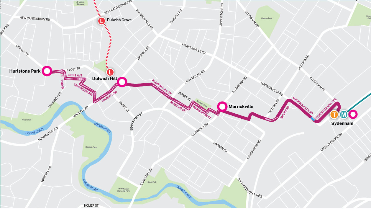
Download Hurlstone Park to Sydenham via Dulwich Hill and Marrickville map (pdf 839KB)
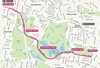
M6 Stage 1 shared pedestrian and cyclist pathway
Download the M6 Stage 1 shared pedestrian and cyclist pathway map (pdf 1.1MB)
Sydney Harbour Bridge cycleway connections
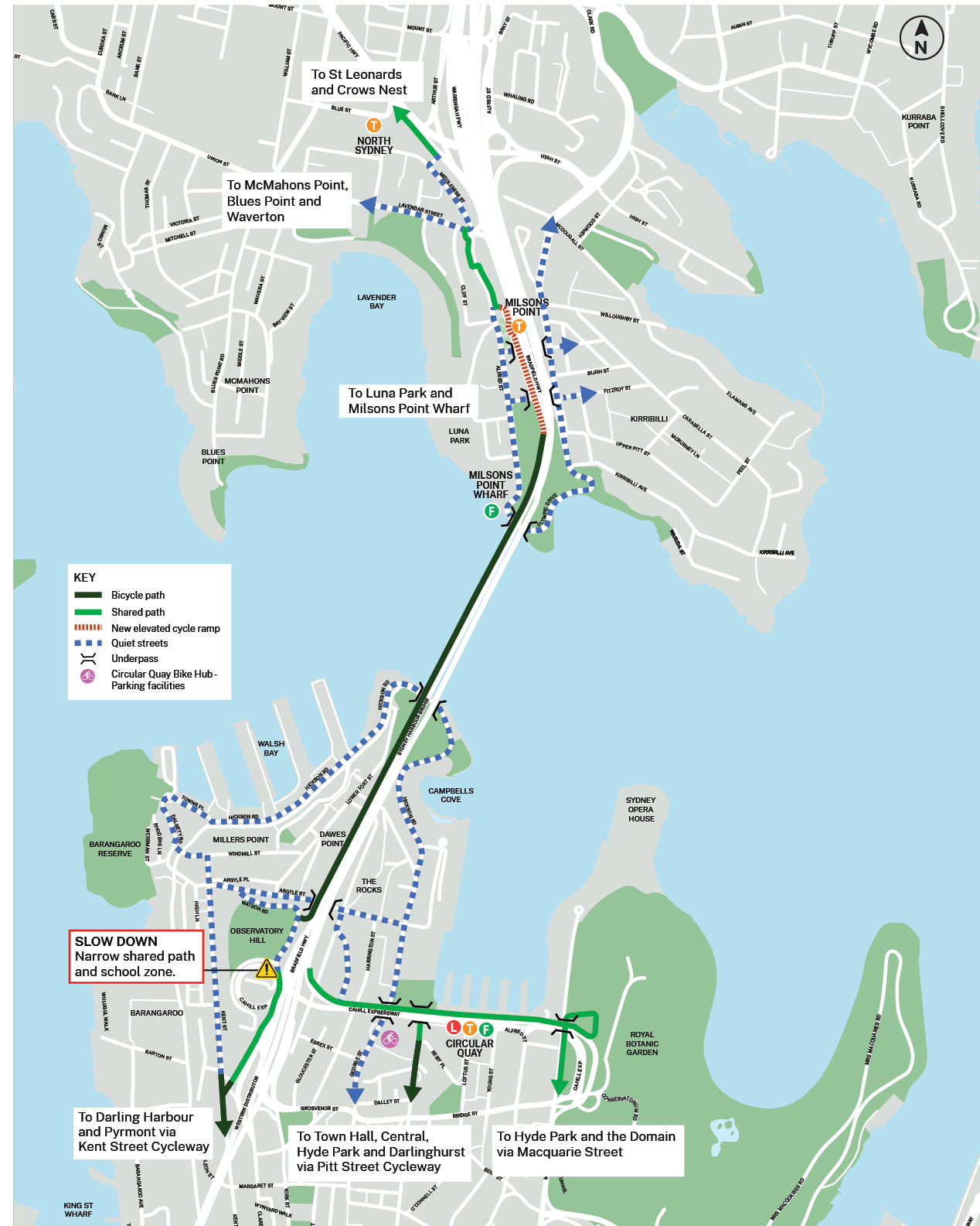
Download the Sydney Harbour Bridge cycleway connections map (pdf 215KB)
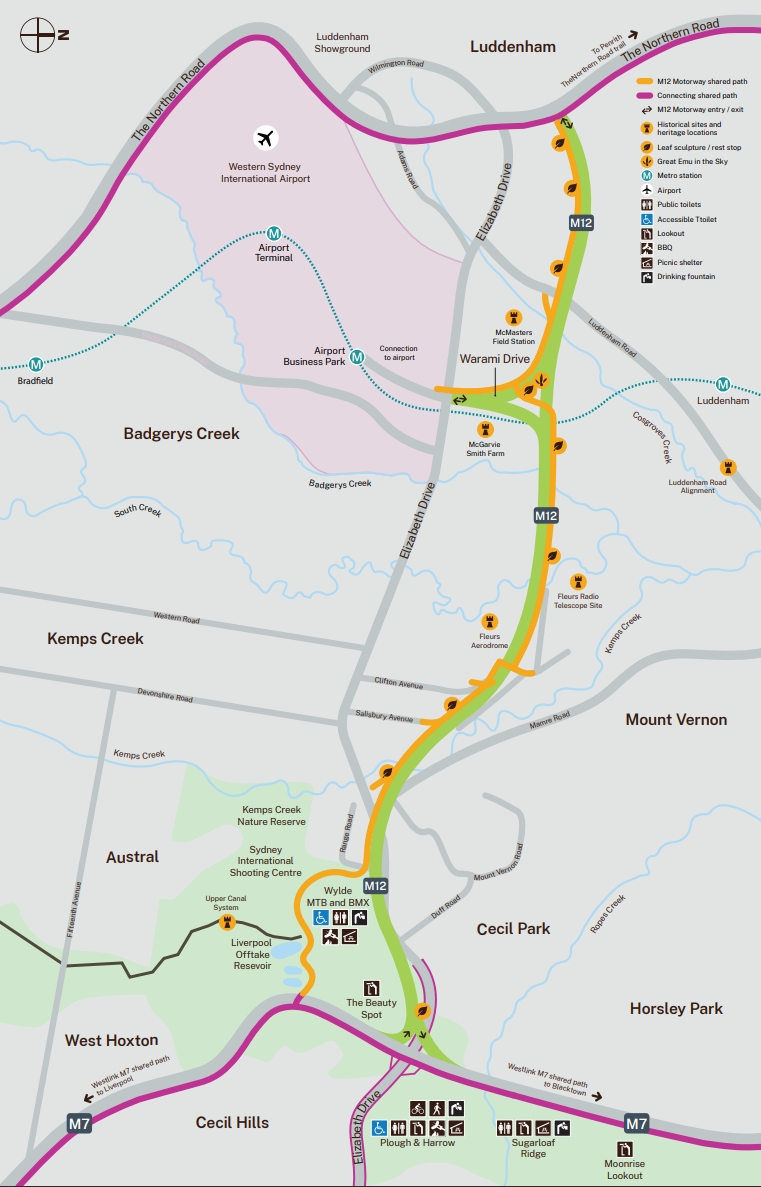
M12 Motorway shared user path
Plan your bike riding trip
Use Trip Planner to plan your bike trip
Use the Trip Planner to plan a bike ride or combine cycling with public transport. You can choose your route, schedule, and ride distance to suit your needs.
Use the Trip Planner to plan your journey in four steps:
- Enter your destination – type a place name or select it on the map.
- Choose your origin – Use your current location, type an address, or pick on the map.
- Set date and time – Tap Leaving now to choose Now, Leave at or Arrive by.
- Select the Cycle tab and select your cycling option:
- Easier – For new cyclists, young riders, or those avoiding hills and busy roads.
- Moderate – For intermediate cyclists comfortable with some hills and occasional road riding.
- More direct – For experienced cyclists who can handle steeper hills and busy roads.
The Trip Planner can combine bike riding with public transport – for example, riding from home to a station, taking the train, then riding to your destination.
You can set whether you want to include bike ride at the start or end of your trip, and how long you are willing to spend bike riding.
To plan a mixed trip:
- Enter your destination and starting point
- Under Filter, choose whether to include cycling at the start and/or end of your trip.
- Set how long you are willing to spend cycling.
Use the Cycleway Finder to find routes near you
Check out the Cycleway Finder to see the network of connected cycleways and shared paths across Sydney, helping you get around safely and easily on your bike.
Cycleway Finder is a database of cycleway infrastructure located throughout NSW which can display attributes of a particular path segment within an area.
Simply search for the location you're interested in and then click on the path detail.
A pop up box will appear showing certain features attributes such as type of road, difficulty level, how steep the road is and the road surface material.
Travelling with bikes
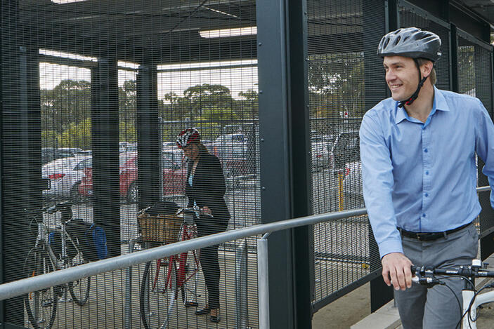
Bike sheds and lockers for bike parking
Bookable bike lockers or Opal enabled bike sheds are available at many stations, wharves and bus interchanges to make your journey easier.
You can look up your station, stop or wharf to check what bike parking facilities are available.
Bike racks are also freely available at most public transport locations.
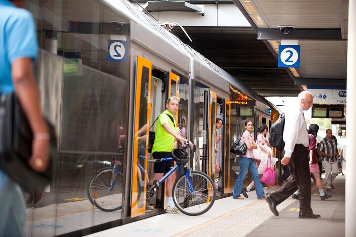
Travelling with bikes on public transport
You can travel on most public transport services with a bike when there is space.
Check out bikes and boards to find out more information on where and when you can take your bike and ticketing information.
Safety tips and road rules
Road safety
Tips for safe riding can help you better share the roads and avoid danger. Visit the Centre for Road Safety website to see how you can ride safely on the road.
Watch how to use the bicycle network videos for commuting and recreation purposes. The videos cover shared paths, how traffic signals detectors work, negotiating with buses and more.
Road rules and road user's handbook
For valuable tips on road safety, bike maintenance, road rules and the legal aspects of riding your bicycle, download the handbook for bicycle riders